" "Courtesy of the University Libraries, The University of Texas at Austin.""
Links to a video discussion with John Hebert, of the Library of Congress, discussing the work of Hotchkiss, one of the most famous cartographers of the Civil War.


{Click to enter modules}
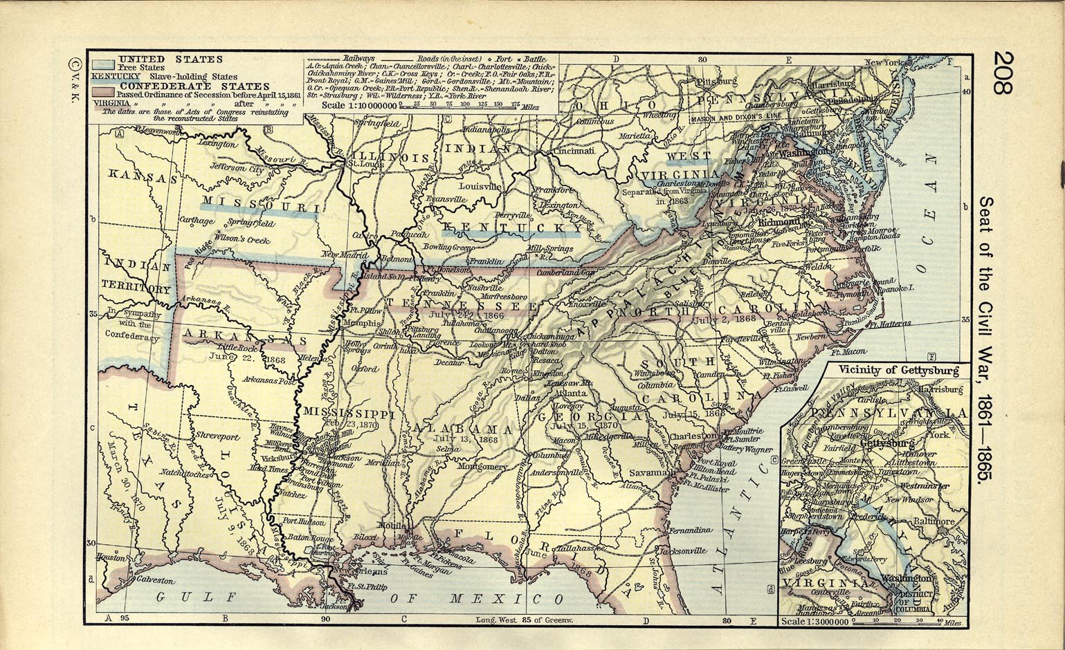
Maps can tell us about the military campaigns, losses and victories. However, maps can also show us conditions in the United States prior to the outbreak of the Civil War. The University of Oregon with its Mapping History website has created modules for some of the most important events in American history. There are individual modules for the status and growth of the cotton industry, as well as the subsequent growth of slavery. The modules continue with territorial expansion, the political environment, election of 1860 and outbreak of war. Choose modules or select resources based upon your student level and degree of sophistication.

Society, National Geographic. Atlas of the Civil War : A Comprehensive Guide to the Tactics and Terrain of Battle.
Swanson, Mark,. Atlas of the Civil War, Month by Month : Major Battles and Troop Movements.
Woodworth, Steven E. Atlas of the Civil War.